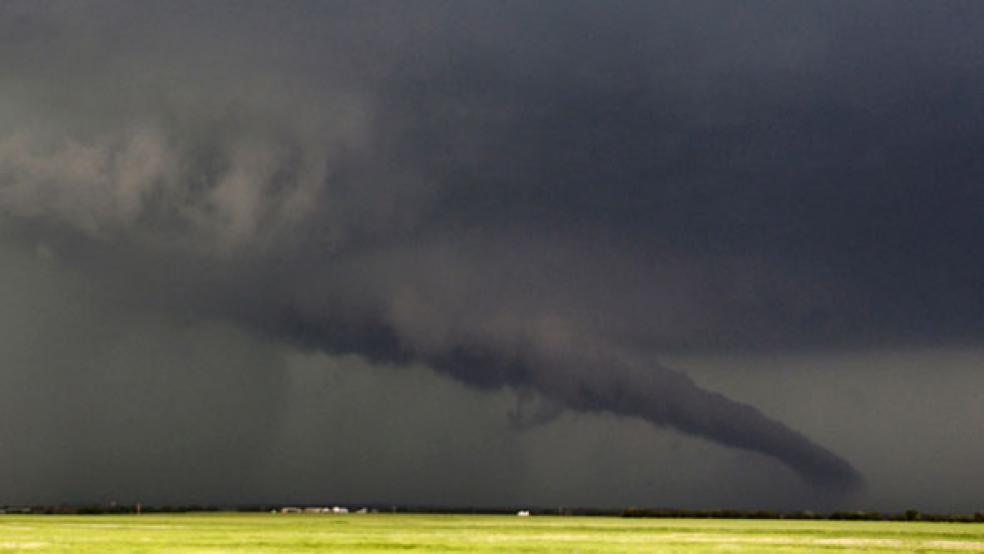
Approximately 16 minutes before the massive twister struck Oklahoma on Monday, meteorologists used satellites and radars to issue a tornado warning in Oklahoma City.
Sixteen minutes may not be much time – but it’s certainly a major advance from 30 years ago, when the average lead time was five minutes. In the 1950s, it was even illegal to predict tornadoes because of the uncertainty and panic that could result from a false forecast. Those 11 additional minutes likely saved more lives as people burrowed into safety shelters and basements. But imagine if they had as much as 30 minutes or more? Would parents have picked up their children from school and sheltered them? Would there have been time to turn off gas sources to avoid fires? New scientific breakthroughs may soon be able to deliver those precious minutes.
RELATED: Oklahoma Tornado One of the Top 5 Costliest in History
Tornadoes are difficult to predict because a thunderstorm can turn into a violent tornado-producing storm within minutes, and tornados can form and disperse just as quickly – unlike hurricanes or blizzards that spend days forming and moving slowly across satellite maps. The false-alarm rate for tornadoes is still at about 75 percent, according to Joshua Wurman, a meteorologist and president of the Center for Severe Weather Research (CSWR) in Colorado.
Categorizing a tornado after it strikes on the Fujita scale from F0 to F5 is also difficult because in addition to wind speed, damage levels need to be assessed. Monday’s tornado was originally classified as an F4, but was revised to an F5 because meteorologists found one spot they thought should be in a higher category. “Even if one spot is rated F5, the tornado is deemed F5,” says Wurman. “I don’t think it’s a good system, but it’s how the weather service does it.”
The National Science Foundation (NSF) provides much of the funding for tornado research. The NSF’s current budget is $6.88 billion, $1.5 million of which goes to the CSWR. Oklahoma itself is a hub for much of the research – some $7 million of federal money goes to Oklahoma’s Department of Commerce for their National Severe Storms Lab every year, a unit of the National Oceanic and Atmospheric Administration (NOAA).
Thanks to years of research, better mathematical models of thunderstorms, and scientists who “chase” tornadoes to study them (think of the 1996 film Twister), predicting tornadoes has come a long way. Recently, there have been a few innovations in the field that could help improve the accuracy of predictions and increase warning times.
1. Multimission Phased-Array Radars (MPAR). These enhanced radars have beams that can scan faster while avoiding unwanted ground clutter – producing clearer, more readable images. Researchers at MIT’s Lincoln Laboratory, a federally funded research and development center, are trying to reduce costs in order to replace current radars on a mass scale and streamline the nation’s weather surveillance system.
2. Drones. Engineering students (with one group calling themselves “the Stormtroopers”) from Oklahoma State University have developed unmanned aerial vehicles that can penetrate the eye of a tornado and collect important meteorological data. Flying the vehicles into a thunderstorm before a tornado hits could also help predict when one will occur. Other drones have been built by an ongoing research project called the Verification of the Origins of Rotation in Tornadoes Experiment 2 (or VORTEX2) by the National Oceanic and Atmospheric Administration (NOAA) and the NSF.
3. More comprehensive radar systems. A group called the Collaborative Adapting Sensing of the Atmosphere (CASA) has been testing experimental radar systems that can provide a fresh image of a storm every minute – a big improvement from traditional radar that typically updates every five minutes. Traditional radars also have blind spots – they have trouble measuring storm activity close to the ground, where a lot of tornado-causing conditions form. The new radars are smaller, can be installed in more places, and send out waves that follow the curve of the earth, all of which helps improve coverage. The CSWR is also working on expanding its Doppler-on-Wheels project to increase the mobility in following a storm’s progress.
4. Gravity waves. Researchers at the University of Alabama, Huntsville, have been studying the effect of gravity waves on tornado formation. The waves are formed by a sudden change in the atmosphere – similar to ocean waves – and can push down on rotating thunderstorms to intensify the wind speed and form funnels. The ability to spot and predict the gravity waves sooner could increase the accuracy of a tornado prediction and save lives.
5. Supercomputing and sophisticated modeling. Supercomputers are behind the National Weather Services’ experimental warning system called Warn-on-Forecast – the researchers involved are hoping to produce accurate warnings 30 minutes to an hour before a tornado strikes. It involves taking extremely high-resolution images of a storm (that currently take too long to produce to track a storm in real-time), and comparing those with quick lower-resolution images.


